Pobierz prezentację
Pobieranie prezentacji. Proszę czekać

1
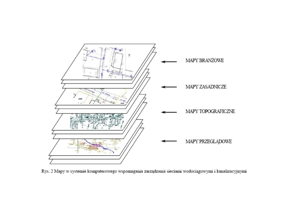
Ewidencja i modelowanie sieci
z wykorzystaniem programów komputerowych

3
3. Ilość uzgodnionych projektów w ZUDP rejestrowanych na:
Ankieta z 2005 r. Polit. Rzesz. 1. W jakim systemie prowadzona jest wersja numeryczna mapy zasadniczej? 2. Jaki procent powierzchni powiatu obejmuje wersja numeryczna mapy zasadniczej? 3. Ilość uzgodnionych projektów w ZUDP rejestrowanych na: nakładce realizacyjnej „R” mapy analogowej warstwach elektronicznych mapy numerycznej innym materiale 4. Ile z powyżej uzgodnionych projektów opracowano na mapie komputerowej z ewentualnym rozbiciem na: mapy numeryczne mapy rastrowe

4
Liczba ankiet przysłanych z poszczególnych województw

5
Liczba instalacji EWMAPY w województwach – stan na IV 2005 r.
56 204 190 85 52 331 57 30 185 113 28 108 23 109 138 114

6
Najpopularniejsze systemy
EWMAPA (45%) MICROSTATION (18%) GEO-INFO (18%)
 MICROSTATION (18%) GEO-INFO (18%)")
7
System ewidencji sieci uzbrojenia terenu SESUT (EW MAPA firmy GEOBID z Katowic)
")
8
SESUT - System Ewidencji Sieci i Uzbrojenia Terenu

9
EWMAPA wersja 9 FB dla Windows (2009 r.)
Program komputerowy do tworzenia, prowadzenia i edycji mapy numerycznej. System przestrzennego zarządzania jednostką administracyjną, np. miastem lub gminą. Można doczytać działki LPIS (Land Parcel Identification System - System Identyfikacji Działek Rolnych – 99% pokrycia kraju), mapy topograficzne, sozologiczne, geologiczne, hydro- braficzne i inne, dystrybuowane na serwerze geoportal.gov.pl
, mapy topograficzne, sozologiczne, geologiczne, hydro- braficzne i inne, dystrybuowane na serwerze geoportal.gov.pl.")
10
Zestawienie ilości prac geodezyjnych zgłoszonych
w 70 Ośrodkach Dokumentacji w 2004 r. Lp. Rodzaj pracy geodezyjnej Licz-ba % 1 MAPY DO CELÓW PROJEKTOWYCH 48230 41 2 INWENTARYZACJE POWYKONAWCZE UZBROJENIA TERENU 31799 27 3 INWENTARYZACJE POWYKONAWCZE POZOSTAŁYCH OBIEKTÓW 14905 13 4 PODZIAŁY DZIAŁEK 14777 5 WZNOWIENIA ZNAKÓW GRANICZNYCH 3405 6 ROZGRANICZENIA NIERUCHOMOŚCI 1034 7 WYŁĄCZENIA Z UŻYTKOWANIA ROLNICZEGO 3786 8 OSNOWY POZIOME 54 0,04 9 OSNOWY WYSOKOŚCIOWE 0,01

11
Ilościowy rozkład uzgodnionych projektów w ZUDP

12
Inne programy komputerowe
Monikan Geosecma WODKAN XP-SWMM inne

13
SIT Geosecma

14
Wspólna baza danych

15
Wprowadzenie do XP-SWMM Moduł GIS
EXPLAIN: This is a short introduction to demonstrate the ease of linking XP-SWMM with external data by using the XP-SWMM GIS Module. Items in CAPS are commands or actions for the presenter.

16
Opis modułu GIS XP-SWMM
Program pozwala: oglądać i wykorzystywać skany jako podkłady importować i eksportować bazy danych Celem jest integracja danych GIS data z XP-SWMM i wyników modelowania ze źródłami danych GIS akceptuje dane typu EXCEL, ACCESS i .DBF Kompatybilny ze wszystkimi systemami GIS dzięki wykorzystaniu technologii OLE i ODBC BASICALLY READ THIS SLIDE. THOUGHTS TO SHARE: Encode shape files means to colour code polygons, lines and nodes based on the table data of the shape file. All current commercial grade database software is OLE or ODBC compliant so the answer is yes it can work with everything they would normally use. Pre configured for Excel, Access and Dbase which covers about 95% of the data our users would encounter. All other sources require the user to set-up the connection by selecting the OLE or ODBC driver, file and a few options.

17
ESRI Shape Files jako podkłady
EXPLAIN: Shape file backgrounds are only permitted when the GIS module has been purchased. Multiple shape files can be used such as several tiles or layers and the files can be turned on and off with the show checkbox.

18
Wprowadzanie i modyfikowanie atrybutów pliku
Shape files can be colour coded based on the table data or the .DBF portion of the shape file. Here the named subcatchments are colour coded. CLICK ON ONE OF THE COLOURS. Clicking on the colour tab will bring up the palette where the user can assign colours to each field value.

19
Zdjęcia lotnicze i podkłady w CAD EXPLAIN:
Other backgrounds include aerial photos such as .jpg, tiff and bmp CLICK WITH MOUSE TO SEE CAD BACKGROUND and Cad files such as .DWG or .DXF can be displayed and do not require the GIS add-on module.

20
Łączy obrazy cyfrowe z odcinkami i węzłami sieci
Przyjmuje obrazy w formatach: BMP, DXF, JPG, TIFF, WMF i innych. EXPLAIN: Digital photos and drawings can be linked to links and nodes. A right mouse-click brings up the pop-up dialog shown. CLICK ON THE VIEW IMAGE COMMAND Simply click on the View Image to show the image here.

21
Import zewnętrznych baz danych z wykorzystaniem technologii OLE i ODBC
EXPLAIN: This is the main component. CLICK ON THE IMPORT/EXPORT EXTERNAL DATABASES MENU ITEM A wizard walks you through the steps to map the source data to the XP-SWMM database. Import and export are permitted. The connection information is saved so simply clicking on the import or export buttons shown later will allow updates. CLICK ON THE NEW ICON Tworzenie nowego połączenia za pomocą okna dialogowego

22
Okna dialogowe dostępu do baz danych
CLICK TO SEE FIRST STEP PICTURE First Step: Select a data file to establish the connection. CLICK ON NEXT TO SEE SECOND STEP PICTURE Second Step: Choose a table, query or named sheet in the source data. Optionally preview the data. CLICK ON THE PREVIEW DATA BUTTON

23
Definiowanie typów połączeń i tworzenie obiektów
CLICK TO SEE EACH IMAGE SAY: Third Step: Select the type of connection, Import Export or both. Fourth Step: Choose options for import and export of create and update or update only. Fifth Step: Select the fields to name and create the objects. Nodes require X and Y to be creates and Links require upstream and downstream nodes.

24
Dane zgodne z formatami bazy danych XP
Step Six: Select the source data fields then using the plus icon expand the tree to find the item you want this field mapped to in XP-SWMM. CLICK ON THE + ICON: All the model data can be mapped. Fields which have no purpose in XP-SWMM can be omitted.

25
Po skonfigurowaniu i kliknięciu, dane mogą być importowane, eksportowane
i zmieniane Once connections and data field mapping are complete the user can simply select the Table that contains the data to be imported or exported and click on the corresponding button. CLICK ON THE IMPORT BUTTON: A message box will confirm the number of nodes or links created and the total number of data fields imported. CLICK ON THE IMPORT BUTTON AGAIN: Two boxes will show up here one for the nodes and one for the links on each mouse-click. An error log will also be displayed if data cannot be imported, is invalid or unreasonable (warning).
.")
26
Sieć utworzona! SAY: Models of thousands of links and nodes can be created in a matter of seconds when the data already exists. However, frequently the data is not complete, has errors or does not contain all the fields required for a hydraulic model. XP-SWMM has many tools allowing you to view, manipulate and report the model data and results. Some of these are shown on the next few slides. EXPLAIN: Additionally, the user can update the GIS source data from XP-SWMM by using the export option.

27
Dane w tabeli XP Allows direct data entry or pasting from databases.
EXPLAIN: XP-Tables allows you to view the imported model data and computed results in Tabular form. Filters can be applied and the data can be sorted ascending and descending. Data can be copied and pasted to and from the tables allowing the user to update the model with simple copy and paste functions. XP-Tables are part of the XP-SWMM software with or without the GIS module. Allows direct data entry or pasting from databases.

28
Podgląd za pomocą Graphical Encoding
SAY: Similar to ArcView where nodes and arcs can be colour coded based on data fields, Graphical Encoding allows you to change the colour, size and label size of nodes and links based on data and results. A legend can be shown and the graphics can be exported or printed directly to colour devices.

29
Opis sieci za pomocą Spatial Reports
SAY: Annotate the network with Spatial Reports. Boxes or brackets can be selected along with the font and colour for you to show data and results in the network view. Spatial reports can be applied to all objects or a selection and can be hidden/shown and their locations can be updated.

30
Tworzenie tabel i sprawozdań
SAY: Custom report templates can be created by the user or simply select one of the existing templates to prepare reports including imported data and model results. These reports can be exported as text or .CSV (comma delimited files) or simply copy and paste to another table application.
 or simply copy and paste to another table application.")
31
EWIGAZ Ewigaz - to system wsparcia logistyki dla przedsiębiorstw posiadających rozległą geograficznie infrastrukturę techniczną (np. Operatorzy Systemów Dystrybucji Gazu, PWiK), gdzie istotne jest nadzorowanie poszczególnych egzemplarzy urządzeń (identyfikowalnych numerem fabrycznym i innymi cechami) celem np. gazomierzy lub wodomierzy.
, gdzie istotne jest nadzorowanie poszczególnych egzemplarzy urządzeń (identyfikowalnych numerem fabrycznym i innymi cechami) celem np. gazomierzy lub wodomierzy.")
32
DZIĘKUJĘ ZA UWAGĘ

Podobne prezentacje